Product overview
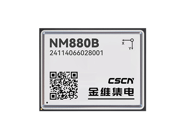
The NM880B combines satellite reception and built-in inertial navigation in a compact module based on Jinwei's NEMO integrated baseband and RF chip. Its receiver covers the listed BDS, GPS, GLONASS, Galileo and QZSS bands, alongside XW-CNL and XW-B2b low Earth orbit augmentation signals. Supported positioning methods include RTK, DGNSS and satellite-internet augmentation, with deeply coupled GNSS+INS processing and INS-assisted computation. This configuration provides an embedded positioning component for integration into a host system.
The 17mm × 22mm × 2.8mm package provides three UART interfaces plus I2C, PPS and SPI connections, and requires a 3.0V–3.6V DC supply. Integration planning must account for mode-dependent output rates: raw data and RTK positioning run at 10Hz with satellite navigation alone, falling to 5Hz when integrated navigation is enabled; integrated-navigation output is 100Hz. Environmental limits are -40°C to +85°C during operation and 95% non-condensing humidity. RTK initialization figures apply to a 10km baseline, while dead-reckoning accuracy is specified for 1km or 2min.
Specifications
| Specification | Value & conditions |
|---|---|
| Manufacturer and model | Changsha Jinwei Integrated Circuit Co., Ltd NM880B |
| Product architecture | Compact high-precision integrated positioning module based on the manufacturer's NEMO integrated baseband and RF chip. |
| Integrated inertial navigation | Built-in inertial navigation with deeply coupled GNSS+INS positioning and INS-assisted computation. |
| Received signal bands |
|
| Positioning modes | RTK, DGNSS, satellite-internet navigation-information-enhanced positioning, and satellite-internet rapid precise positioning. |
| Navigation augmentation signal integration | Receives XW-CNL and XW-B2b signals and supports their fusion with GNSS positioning. |
| Update rates |
|
| Single-point positioning accuracy | Horizontal ≤1.5m; elevation ≤3.0m.1σ. |
| DGNSS accuracy | Horizontal ≤0.3m+10ppm; elevation ≤0.6m+10ppm.1σ. |
| RTK accuracy | Horizontal ≤1cm+1ppm; elevation ≤2cm+1ppm.1σ. |
| Augmented positioning | Time to first fix ≤10s; positioning accuracy ≤1m.Navigation-information augmentation; positioning accuracy at 1σ. |
| Rapid precise positioning performance | Convergence time ≤1min; horizontal accuracy ≤0.1m; elevation accuracy ≤0.2m.Rapid precise positioning; positioning accuracy at 1σ. |
| Integrated-navigation dead-reckoning accuracy | 2% × distance travelled.1km or 2min. |
| Timing accuracy | ≤20ns.1σ. |
| Velocity measurement accuracy | ≤0.05m/s.1σ. |
| Cold-start time | ≤35s.Cold start. |
| Hot-start time | ≤5s.Hot start. |
| Reacquisition time | ≤1s. |
| RTK initialization time | ≤5s.10km baseline. |
| RTK initialization reliability | ≥99.9%.10km baseline. |
| Supported protocols | RTCM2.X, RTCM3.X, NMEA-0183, and a custom protocol. |
| Dimensions | 17mm × 22mm × 2.8mm. |
| Supply voltage | 3.0V–3.6V DC.DC supply. |
| Humidity | 95%.Non-condensing. |
| Operating temperature | -40°C to +85°C.Operation. |
| Storage temperature | -55°C to +125°C.Storage. |
| Functional interfaces | 3 × UART, 1 × I2C, 1 × PPS, 1 × SPI. |
Request a quote for NM880B
Send your application, destination country and expected quantity to the ChinaDrone team. We can discuss product selection, configuration and sourcing from China.
Submit your procurement requirements ↗No account needed. A model number is optional. Your enquiry is handled by ChinaDrone.