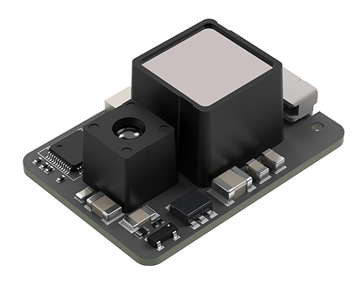
Product overview
The Wuxi Beiwei Sensing Technology BW-VG220E is a voltage-output dynamic inclination sensor for integration into equipment requiring pitch and roll measurements. Its applications include unmanned aircraft, platform stabilization, robotics, autonomous driving, underwater ROV navigation, vessels, and construction and agricultural machinery. The hardware occupies a rectangular envelope measuring 104 mm long, 62 mm wide and 50 mm high. This is a sensing component for a host system, rather than a complete flight platform or an airframe kit.
Integration requires a 12-36V DC supply, with operating current of 20-60mA under no-load conditions. Interfaces comprise serial communication at 9600 to 460800 baud and support for up to four analog output channels. Measurement coverage is pitch ±90° and roll ±180°, with 0.5° dynamic accuracy, 0.01° static accuracy and 0.01° resolution. Startup delay is below 50ms. Operating temperature extends from -40 to 85°C; shock resistance is 2000g for 0.5ms, with three shocks per axis.
Specifications
| Specification | Value & conditions |
|---|---|
| Product identity | Wuxi Beiwei Sensing Technology BW-VG220E low-cost voltage-output dynamic inclination sensor |
| Supply voltage | 12-36V DC |
| Operating current | 20-60mANo load. |
| Operating temperature | -40 to 85°C |
| Storage temperature | -55 to 100°C |
| Dynamic accuracy | 0.5°Dynamic measurement. |
| Static accuracy | 0.01°Static measurement. |
| Resolution | 0.01° |
| Inclination range | Pitch ±90°; roll ±180° |
| Dimensions | L104 × W62 × H50 mm |
| Startup delay | Less than 50ms |
| Serial communication rate | 9600 to 460800 baud |
| Analog outputs | Up to 4 analog output channels |
| Mean time between failures | ≥30000 hours |
| Electromagnetic compatibility | According to GBT17626 |
| Shock resistance | 2000g0.5ms; 3 shocks per axis. |
| Application areas | Ships and vessels; construction machinery; platform stabilization; agricultural machinery; underwater ROV navigation; autonomous driving; robotics; unmanned aircraft |
Request a quote for BW-VG220E
Send your application, destination country and expected quantity to the ChinaDrone team. We can discuss product selection, configuration and sourcing from China.
Submit your procurement requirements ↗No account needed. A model number is optional. Your enquiry is handled by ChinaDrone.