Product overview
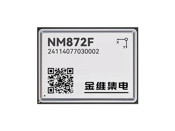
The NM872F provides positioning and heading functions in a 16 mm × 21 mm × 2.8 mm module built around Jinwei’s NEMO chip, which integrates baseband and radio-frequency functions. Built-in inertial navigation supports deeply coupled GNSS+INS processing and INS-assisted calculations. The module supports RTK, DGNSS and PPP positioning, alongside dual-antenna heading calculation and an anti-multipath design. RTK accuracy is ≤1 cm + 1 ppm horizontally and ≤2 cm + 1 ppm vertically at 1σ; heading accuracy is 0.2° at 1σ with a 1 m baseline.
The module requires a 3.0–3.6 V DC supply and provides three UART interfaces plus one each of I2C, PPS and SPI. It receives the specified BDS, GPS, GLONASS, Galileo and QZSS signals, with SBAS L1 reception optional. Raw-data and RTK positioning updates run at 10 Hz, reducing to 5 Hz when integrated navigation is enabled; integrated-navigation output is 100 Hz. Operating temperature is -40°C to +85°C, with 95% non-condensing humidity. Integrated-navigation dead-reckoning accuracy is 2% of distance traveled over 1 km or 2 minutes.
Specifications
| Specification | Value & conditions |
|---|---|
| Manufacturer and model | Changsha Jinwei Integrated Circuit Co., Ltd NM872F integrated positioning and heading module. |
| Chip architecture | NEMO chip integrating high-precision baseband and radio-frequency functions. |
| Positioning modes | RTK, DGNSS and PPP positioning, with centimeter-, decimeter- and meter-level positioning services. |
| Integrated inertial navigation | Built-in inertial navigation with deeply coupled GNSS+INS positioning and INS-assisted calculations. |
| Heading architecture | RTK positioning and heading, anti-multipath design and dual-antenna heading calculation.Dual-antenna heading calculation. |
| Satellite signal reception |
|
| Raw-data update rate | 10 Hz; 5 Hz with integrated navigation enabled.5 Hz with integrated navigation enabled. |
| RTK positioning update rate | 10 Hz; 5 Hz with integrated navigation enabled.5 Hz with integrated navigation enabled. |
| Integrated-navigation update rate | 100 Hz.Integrated navigation. |
| Single-point positioning accuracy | Horizontal: ≤1.5 m; elevation: ≤3.0 m.Single-point positioning; 1σ. |
| DGNSS accuracy | Horizontal: ≤0.3 m + 10 ppm; elevation: ≤0.6 m + 10 ppm.DGNSS positioning; 1σ. |
| RTK accuracy | Horizontal: ≤1 cm + 1 ppm; elevation: ≤2 cm + 1 ppm.RTK positioning; 1σ. |
| Heading accuracy | 0.2°.1σ; 1 m baseline. |
| Dead-reckoning accuracy | 2% × distance traveled.Integrated-navigation dead reckoning over 1 km or 2 min. |
| Timing accuracy | ≤20 ns.RMS. |
| Velocity accuracy | ≤0.05 m/s.RMS. |
| Cold-start time | ≤35 s.Cold start. |
| Hot-start time | ≤5 s.Hot start. |
| Reacquisition time | ≤1 s. |
| RTK initialization time | ≤5 s.10 km baseline. |
| RTK initialization reliability | ≥99.9%.10 km baseline. |
| Supported protocols | RTCM2.X, RTCM3.X, NMEA-0183 and a custom protocol. |
| Dimensions | 16 mm × 21 mm × 2.8 mm. |
| Supply voltage | 3.0–3.6 V DC.DC supply. |
| Humidity | 95%, non-condensing.Non-condensing. |
| Operating temperature | -40°C to +85°C.Operating. |
| Storage temperature | -55°C to +125°C.Storage. |
| Functional interfaces | 3 × UART, 1 × I2C, 1 × PPS and 1 × SPI. |
Request a quote for NM872F
Send your application, destination country and expected quantity to the ChinaDrone team. We can discuss product selection, configuration and sourcing from China.
Submit your procurement requirements ↗No account needed. A model number is optional. Your enquiry is handled by ChinaDrone.