Product overview
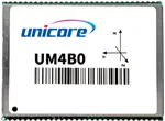
The UM4B0 from Unicore Communications, Inc. is a historical product designed for embedded RTK positioning in UAVs, lightweight robots, GIS data collection equipment and intelligent driving systems. It combines a NebulasII SoC and 432 tracking channels in a surface-mount package measuring 30 × 40 × 4 mm and weighing approximately 9.2 g. Multi-frequency signal support covers BDS, GPS, GLONASS, Galileo and QZSS, with BDS B1C and B2a marked as optional configurations in the manual. Interference and multipath suppression support navigation in challenging signal environments.
The module provides 20 Hz positioning and data updates, with RTK RMS accuracy specified as 10 mm + 1 ppm horizontally and 15 mm + 1 ppm vertically. RTK operation uses satellite observations together with differential corrections from a reference station; typical initialization takes less than 5 seconds. Three LV-TTL UART ports and an LV-TTL 1PPS output support integration, while the Event input is configuration dependent. Data output includes NMEA-0183 and Unicore Binary. RTK, heading and DGPS functions depend on the purchased configuration.
Typical power consumption is 1.8 W, and the operating temperature range is −40°C to +85°C, with humidity specified at 95% under noncondensing conditions. Hardware integration requires a stable power supply and a suitable GNSS antenna connection with 50-ohm impedance matching. Antenna open-circuit and short-circuit detection is valid only when the antenna receives power through ANT_PWR. UPrecise software supports configuration, logging and firmware updates, with module firmware upgrades restricted to UART1.
Specifications
| Specification | Value & conditions |
|---|---|
| Product architecture and purpose | Unicore UM4B0 all-constellation, all-frequency RTK positioning module built around the NebulasII SoC. |
| Satellite signal support | BDS B1I/B2I/B3I/B1C/B2a; GPS L1/L2/L5; GLONASS L1/L2; Galileo E1/E5a/E5b; QZSS L1/L2/L5. |
| Channels | 432 channels, based on the Nebulas-II chip. |
| Observation accuracy and listed frequencies | Listed frequencies: BDS B1/B2/B3, GPS L1/L2/L5, GLONASS L1/L2 and Galileo E1/E5a/E5b. Across the BDS, GPS, GLONASS and Galileo columns, B1/L1(C/A)/E1 code and B2/L2P(Y)/L2C/E5b code accuracy are 10 cm; B1/L1/E1, B2/L2p(Y)/L2C/E5b and B3/L5/E5a carrier-phase accuracy are 1 mm.RMS observation accuracy. |
| Single-point positioning accuracy | Horizontal: 1.5 m; vertical: 2.5 m.Single-point positioning. |
| Initialization time | Less than 5 s (typical).Typical initialization time. |
| Initialization reliability | Greater than 99.9%. |
| DGPS accuracy | Horizontal: 0.4 m; vertical: 0.8 m.DGPS; RMS accuracy. |
| Reacquisition | Less than 1 s. |
| Correction formats | RTCM v2.3/3.0/3.2. |
| RTK positioning accuracy | Horizontal: 10 mm + 1 ppm; vertical: 15 mm + 1 ppm.RTK; RMS accuracy. |
| Data output | NMEA-0183 and Unicore Binary. |
| Update and positioning rates | Update rate: 20 Hz; positioning rate: 20 Hz. |
| Velocity accuracy | 0.03 m/s.RMS accuracy. |
| Time to first fix | Cold start: less than 25 s; hot start: less than 10 s.Cold start or hot start, respectively. |
| Time accuracy | 20 ns.RMS accuracy. |
| Dead reckoning error | Less than 5% of distance travelled.GPS-denied conditions. |
| Network protocols | NTRIP and TCP/IP. |
| Dimensions and packaging | 30 × 40 × 4 mm. |
| Weight | 9.2 g. |
| Functional ports | 3 × UART (LV-TTL); 1 × 1PPS (LV-TTL); 1 × Event input.UART and 1PPS use LV-TTL signaling. |
| Operating temperature | -40°C to +85°C.Working temperature. |
| Storage temperature | -55°C to +95°C.Storage temperature. |
| Humidity | 95%, noncondensing.No condensation. |
| Vibration | GJB150.16-2009; MIL-STD-810. |
| Shock | GJB150.18-2009; MIL-STD-810. |
| Supply voltage | 3.3 VDC +5%/−3%.Supply tolerance: +5%/−3%. |
| LNA electrical specification | 4.75–5.0 V; 0–100 mA. |
| Ripple voltage | 100 mV p-p (max).Maximum peak-to-peak ripple. |
| Power consumption | 1.8 W (typical).Typical power consumption. |
| Model and function | UM4B0 RTK positioning and heading moduleAvailable functions depend on the purchased configuration. |
| Configuration limitation | Select RTK, heading and DGPS guidance according to the purchased configuration.The manual is a general version covering different configurations. |
| Catalog status | Historical productListed in the supplied Unicore website excerpt. |
Request a quote for Unicore UM4B0
Send your application, destination country and expected quantity to the ChinaDrone team. We can discuss product selection, configuration and sourcing from China.
Submit your procurement requirements ↗No account needed. A model number is optional. Your enquiry is handled by ChinaDrone.