Product overview
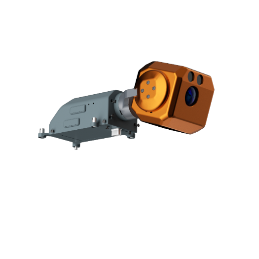
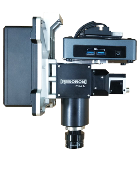
The Ruitu Wanfang HS-RPL is an aircraft-mounted hyperspectral imaging system for water-quality monitoring, pest and disease analysis, forestry surveys and land-cover classification. Its architecture combines a Resonon Pika L imager with high-precision attitude and positioning equipment to address imaging degradation caused by flight vibration. Pushbroom acquisition covers 400–1000 nm through 281 spectral channels and 900 spatial channels, with 2.1 nm spectral resolution. The system serves as an airborne imaging payload, with RT650 and DJI M600 Pro identified as carrier platforms.
Installation planning must accommodate dimensions of 19.57 × 14.05 × 22.4 cm and a mass of 2.7 kg excluding the gimbal. The system uses USB 3.0 and accepts 12–24 V input; power is specified as 3.4 W, with supported maximum power separately given as 13–16 W. Field-of-view options span 4.3° to 47.4° with corresponding lens focal lengths. Supplied control software manages acquisition, exposure and camera/GPS/IMU settings. Processing software adds radiometric calibration, reflectance correction, geographic correction, visualization and batch processing, with ENVI-compatible data formats.
Specifications
| Specification | Value & conditions |
|---|---|
| System identity and architecture | HS-RPL airborne imaging system with integrated high-precision attitude and positioning equipment. |
| Imager model | Resonon Pika L |
| Spectral range | 400–1000 nm |
| Spectral channels | 281 |
| Spatial channels | 900 |
| Spectral resolution | 2.1 nm |
| Spectral sampling | 1.07 nm/pixel |
| Aperture | F/2.4 |
| Total field of view | 4.3°/6.1°/13.1°/17.6°/24.8°/36.5°/47.4°; corresponding focal lengths have no stated unit.Corresponding lens focal lengths: 70/50/23/17/12/8/6. |
| Instantaneous field of view | 0.21/0.30/0.65/0.88/1.25/2.50 mrad |
| Pixel size | 5.86 µm |
| Bit depth | 12 bits |
| Maximum frame rate | 249 fps |
| Dimensions | 19.57 × 14.05 × 22.4 cm |
| Data interface | USB 3.0 |
| Weight | 2.7 kgExcludes the gimbal. |
| Power | 3.4 W |
| Carrier platforms | RT650 / DJI M600 Pro |
| Input voltage | 12–24 V |
| Supported maximum power | 13–16 W |
| Imager power consumption | 3.4; no unit stated for this entry. |
| Imager data interface | USB 3.0 |
| Integrated positioning data frequency | 100 Hz |
| GNSS support | GPS, GLONASS, Galileo and BeiDouGalileo supports single- or dual-antenna configurations. |
| Position | Horizontal: 0.01 m; elevation: 0.02 m |
| Velocity | 0.015 m/sHorizontal component. |
| Roll and pitch | 0.005° |
| Heading | 0.01° |
| Acquisition method | Pushbroom hyperspectral image acquisition. |
| Supplied software | Control software supports acquisition, equipment status checks, automatic exposure, hyperspectral camera parameters, GPS/IMU settings and target-area settings. Processing and analysis software supports visualization, radiometric calibration, reflectance correction, geographic correction and batch processing, with data formats compatible with ENVI and other third-party analysis software. |
Request a quote for HS-RPL
Send your application, destination country and expected quantity to the ChinaDrone team. We can discuss product selection, configuration and sourcing from China.
Submit your procurement requirements ↗No account needed. A model number is optional. Your enquiry is handled by ChinaDrone.