ChinaDroneRequest a quote →

RTK GNSS Antenna MT-184

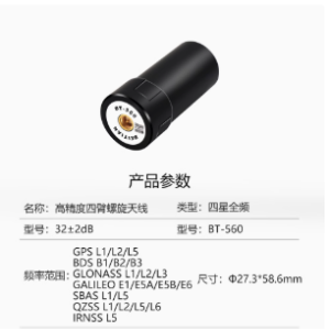
The MoneyPro RTK GNSS Antenna MT-184 is a four-constellation, full-frequency reference station antenna supporting GPS, GLONASS, Beidou and Galileo. High-gain reception and low-noise amplification enable centimeter-level positioning, while its compact, durable construction and dust and water protection suit surveying, agriculture, construction and UAV positioning.

MoneyProDrone GPS
Positioning accuracy
Centimeter-level positioning

Get a free quote

Product overview

The MoneyPro RTK GNSS Antenna MT-184 is a four-constellation, full-frequency reference station antenna for professional positioning, surveying, mapping and geospatial data collection. It supports GPS, GLONASS, Beidou and Galileo, combining high-gain reception with low-noise amplification to enable centimeter-level positioning. This design reduces signal interference and supports positioning stability during extended work. Its multi-system reception also supports signal acquisition in demanding surroundings, including dense urban areas and remote rural locations with limited sky exposure.

A compact, durable structure incorporates IP-rated protection against dust and water for field applications. The easy-to-mount design supports integration with various RTK receivers, while compatibility with a variety of satellite navigation receivers allows use across different positioning setups. Applications include land and geodetic surveying, waterway surveying and mapping, construction site layout, precision agriculture and UAV positioning. The MT-184 also serves deformation monitoring and geological disaster monitoring applications.
Flight control & navigation

Specifications

RTK GNSS Antenna MT-184 specifications
SpecificationValue & conditions
Product typeFour-constellation, full-frequency RTK GNSS reference station antenna
Supported satellite systemsGPS, GLONASS, Beidou, and Galileo
Positioning accuracyCentimeter-level positioning
Antenna designHigh-gain design with low-noise amplification
ConstructionCompact, durable structure
Environmental protectionIP-rated protection against dust and water
MountingEasy-to-mount design for integration with various RTK receivers
Receiver compatibilityCompatible with a variety of satellite navigation receivers
Surveying and monitoring applicationsGeodetic surveying, waterway surveying and mapping, precision agriculture, deformation monitoring, and geological disaster monitoring
Additional positioning applicationsLand surveying, precision agriculture, construction site layout, and UAV positioning

Related guides