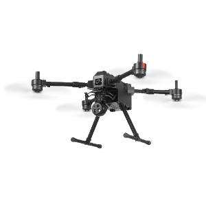
Product overview
The HAWKUN INTELLIGENCE P14 is a pure electric UAV for aerial surveying and mapping. Its four-axis tilt-rotor architecture enables vertical take-off and landing alongside fixed-wing flight. A large wing area supports varied payloads, and a spacious cabin provides integration space. The flight platform measures 1350mm×2500mm×400mm and has a take-off weight of 14kg. Its battery configuration is two 6S 22.8V 25000mAh lithium polymer batteries. Flight controls support autonomous take-off and landing, while ground station software generates survey routes from operator-defined ground resolution and image overlap.
The P14 cruises at 20m/s, reaches a maximum speed of 32m/s and has a stall speed below 15m/s. Load endurance is ≥120min, with a 5000m ceiling, 12m/s wind resistance, a -20~45°C operating range and a 5*5m take-off and landing site. Navigation combines GPS, BeiDou and GLONASS with PPK processing. During fixed-wing flight, stall or attitude loss of control triggers multirotor assistance. Following a return caused by low battery or weather factors, replacing the battery allows the aircraft to resume remaining missions without replanning.
Specifications
| Specification | Value & conditions |
|---|---|
| Aircraft architecture | Pure electric fixed-wing UAV with a four-axis tilt-rotor structure and vertical take-off and landing capability |
| Payload integration space | Large wing area supporting varied payloads; spacious cabin |
| Ground resolution | Better than 2cm |
| Take-off and landing mode | Tilt-rotor vertical take-off and landing |
| Flight mode | Fixed-wing mode |
| Cruise speed | 20m/s (maximum speed: 32m/s, stall speed less than 15m/s) |
| Take-off weight | 14kg |
| Ceiling | 5000m |
| Dimensions | 1350mm×2500mm×400mm |
| Navigation satellite | GPS: L1+L2, BeiDou: B1+B2, GLONASS: L1+L2 |
| Differential mode | PPK post-differential |
| Landing accuracy | Horizontal ≤±0.3m, elevation ≤±0.3m |
| Wind resistance | 12m/s |
| Operating temperature | -20~45℃ |
| Load endurance | ≥120minUnder load. |
| Take-off and landing site | 5*5m |
| Battery | 6S 22.8V 25000mAh*2 lithium polymer battery |
| Autonomous flight | Fully autonomous take-off and landing, with no remote control or human intervention required during flight |
| Multirotor recovery assistance | Automatic activation of the multirotor system for auxiliary flightDuring fixed-wing flight, if stall or attitude loss of control occurs. |
| Mission continuation | Automatic resumption of remaining missions without replanningFollowing an automatic or manual return due to low battery or weather factors, after battery replacement. |
| Dynamic waypoint control | Waypoint changes, waypoint skipping, mission pause and hoveringDuring flight. |
| Flight recorder | Built-in flight-data recorder with recording time exceeding 100 hoursOld data is automatically deleted if storage space is insufficient. |
| POS data handling | Automatic POS storage retained after power-off; one-click export via radio or USB |
| Automatic survey route generation | Automatic basic route generation from ground-resolution and image-overlap settingsThe operator defines ground resolution and image overlap. |
| Terrain clearance warning | Automatic terrain self-check with a red route warning when too close to the groundAfter survey mission planning; insufficient terrain clearance requires flight-altitude adjustment. |
| Ground station computer | Operates on ordinary computers or notebooks |