ChinaDroneRequest a quote →

Rubidium optically pumped magnetometer aeromagnetic system

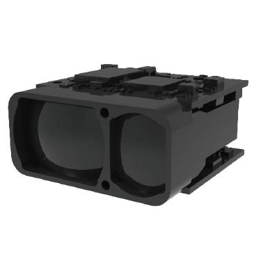
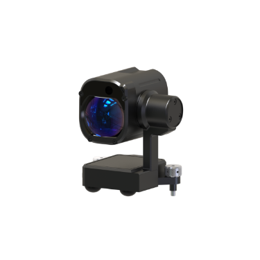
The GTK (Shenzhen) Technology Co., Ltd. Rubidium optically pumped magnetometer aeromagnetic system combines magnetic sensing, TEK positioning, airborne data processing and wireless transmission. Its geographical information system software supports collection, processing, mapping and positioning, while a handheld search mode enables real-time search and location of magnetic source targets.

GTKDrone flight controller

Get a free quote

Product overview

The GTK (Shenzhen) Technology Co., Ltd. Rubidium optically pumped magnetometer aeromagnetic system combines a rubidium optical pump magnetic sensor with data acquisition and processing software. Its magnetic measurement range is 1000-100000 nT, with accuracy of 20pT/GHz and sensitivity of ±0.001 nT over 0.1-100 Hz. The maximum gradient is 100 nT/cm, and the working temperature range is -15-55 °C. Airborne processing and wireless transmission support its magnetic field and attitude data acquisition capabilities.

The acquisition system incorporates high-speed, high-precision TEK positioning with accuracy less than 10 cm and a maximum sampling frequency of 200 Hz. Its geographical information system software brings data collection, processing, mapping and positioning into one workflow, running across systems on computers, mobile phones and tablets. For magnetic source target location, the system also supports a handheld search mode that provides real-time, high-precision search and positioning.
Cameras & sensors

Specifications

Rubidium optically pumped magnetometer aeromagnetic system specifications
SpecificationValue & conditions
ManufacturerGTK (Shenzhen) Technology Co., Ltd.
ProductRubidium optically pumped magnetometer aeromagnetic system
Magnetic sensorRubidium optical pump magnetometer
Accuracy20pT/GHz
Sensitivity±0.001 nTFrequency range: 0.1-100 Hz.
Range1000-100000 nT
Maximum gradient100 nT/cm
Working temperature-15-55 °C
Data acquisition systemHigh-speed, high-precision TEK positioning (accuracy less than 10 cm), magnetic field, attitude and other data acquisition, with airborne data processing and wireless transmission; maximum sampling frequency: 200 Hz
Data processing softwareGeographical information system platform for data collection, processing, mapping and positioning
Software platformsRuns across systems on computers, mobile phones and tablets
Magnetic source target searchReal-time, high-precision search and positioning of magnetic source targetsHandheld search mode.

Related guides