Product overview
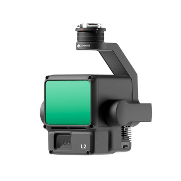
DJI Zenmuse L2 is an aerial mapping payload combining LiDAR, a DJI-developed positioning and orientation system, and a 20-megapixel 4/3 CMOS RGB mapping camera. It supports terrain mapping, transmission-line corridor modeling, forestry surveys and engineering surveys, with DJI Terra providing point-cloud post-processing. Typical measuring range is 250 m at 10% reflectivity and 100 klx, or 450 m at 50% reflectivity and 0 klx. These values apply to a flat target larger than the laser beam, with perpendicular incidence and 23 km atmospheric visibility. Sunny conditions shorten range compared with cloudy conditions, and multiple targets within one beam can reduce measurable distance by dividing the pulse energy. Measurement cuts off at 500 m.
L2 supports repetitive and non-repetitive scanning. Repetitive scanning provides more uniform coverage for high-precision mapping, with a 70° horizontal and 3° vertical field of view. Non-repetitive scanning retains the 70° horizontal field and expands the vertical field to 75°, offering greater penetration and structural detail for power-line inspection and forestry surveys. Five return modes span single return, which records the strongest return, through five returns. Maximum point-cloud rates are 240,000 points per second in single-return mode and 1,200,000 points per second in multiple-return modes. Recommended operating height is 30–150 m.
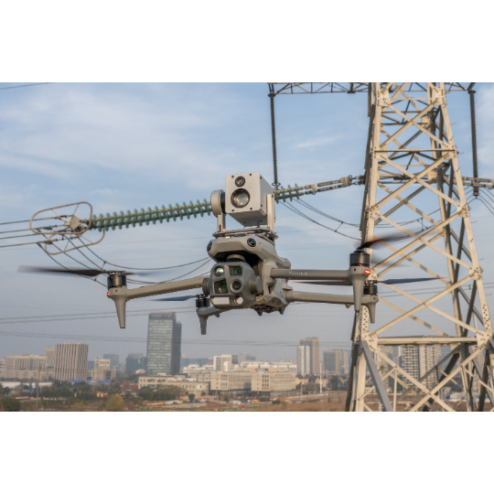
Compatible aircraft are Matrice 400, Matrice 350 RTK and Matrice 300 RTK; Matrice 300 RTK requires DJI RC Plus. On Matrice 350 RTK and Matrice 300 RTK, L2 requires the lower single-gimbal assembly connected to the aircraft's bottom-right USB-C port when facing the nose; an incorrect connection reduces mapping accuracy. Matrice 400 accepts L2 on the lower single-gimbal assembly or either position of the dual-gimbal assembly, although carrying another payload alongside L2 on the dual assembly reduces mapping accuracy. No warm-up is required: operation can begin once the aircraft's RTK status is FIX. Heading calibration is required to maintain data accuracy.
DJI Pilot 2 displays thinned point-cloud previews colored by reflectivity, height, distance or true color. Recorded models can be previewed and models from multiple flights combined, with playback and combination requiring the aircraft and L2 to remain connected. These previews differ in point count and accuracy from models reconstructed in DJI Terra. The RGB camera supplies real-time point-cloud color and photographs for visible-light reconstruction. L2 weighs 905 ± 5 g and operates from -20°C to 50°C. It reaches IP54 protection under controlled laboratory conditions, with protection potentially declining through use and wear. Installation requires dry gimbal surfaces and connectors, secure mounting, and a clean, closed microSD cover; the body surface must be wiped clean before opening that cover.
Specifications
| Specification | Value & conditions |
|---|---|
| Sensor configuration | LiDAR module, IMU system and RGB mapping cameraConfiguration described for Zenmuse L2 on DJI flight platforms. |
| 3D workflow | 3D data collection and post-processingIn conjunction with DJI Terra. |
Request a quote for DJI Zenmuse L2
Send your application, destination country and expected quantity to the ChinaDrone team. We can discuss product selection, configuration and sourcing from China.
Submit your procurement requirements ↗No account needed. A model number is optional. Your enquiry is handled by ChinaDrone.