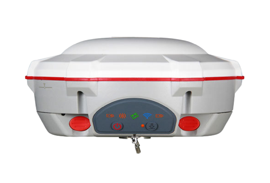
Product overview
In ComNav's Shanghai mapping case study, the T300 Plus was placed on a known control point and connected to a DJI Phantom 4 RTK through Wi-Fi to transmit correction data.
The receiver can also operate as a rover to measure checkpoint coordinates for accuracy validation.
The T300 Plus supports PPK as a backup when RTK is unavailable, with PPK operation possible alongside RTK.
Specifications
| Specification | Value & conditions |
|---|---|
| UAV correction link | Wi-Fi correction transmission to DJI Phantom 4 RTKDocumented project configuration with the T300 Plus set up on a known control point. |
| Backup positioning workflow | PPK backup alongside RTKProvided for situations where RTK is not applicable. |
| Model | ComNav T300 Plus GNSS Receiver |
| GNSS channels | 965 |
| Tracked signals |
|
| GNSS technology | Advanced QUANTUM™ Generation III |
| Signal reacquisition and startup times |
|
| Initialization | Time: less than 10 s; reliability: greater than 99.9%RTK initialization. |
| Static positioning accuracy | Horizontal: 2.5 mm + 0.5 ppm; vertical: 5 mm + 0.5 ppmStatic and fast static; RMS. |
| RTK positioning accuracy | Horizontal: 8 mm + 1 ppm; vertical: 15 mm + 1 ppmReal-time kinematic; RMS. |
| Long-observation static accuracy | Horizontal: 3 mm + 0.1 ppm; vertical: 3.5 mm + 0.4 ppmLong-observation static. |
| DGPS, SBAS and standalone accuracy |
|
| Dimensions | 15.8 cm × 7.5 cm |
| Weight | 0.95 kgWith two batteries. |
| Temperature limits | Operating: -40 °C to +65 °C (-40 °F to 149 °F); storage: -40 °C to +85 °C (-40 °F to 185 °F) |
| Humidity | 100%Non-condensing. |
| Water and dust protection | IP67Temporary immersion to a depth of 1 m. |
| Drop resistance | Survives a 2 m dropDrop onto concrete. |
| Power input and consumption | Input: 7–28 VDC; consumption: 1.92 W |
| Battery capacity and runtime | Li-ion: 2 × 2000 mAh; up to 10 hoursRuntime is typical. |
| Memory | 8 GB |
| Serial interface | 1 × 7-pin Lemo serial port; baud rates up to 921,600 bps |
| UHF modem |
|
| Wi-Fi | 802.11b/g/n; 2.4 GHz |
| Cellular modem | 4G: 800/900/1800/2100/2600 MHz; 3G: 900/2100 MHz; 2G: 900/1800 MHz; supports GSM, Point to Point/Points and NTRIP |
| Position output rates | 1 Hz, 2 Hz, 5 Hz, 10 Hz, 20 Hz |
| Indicator LEDs | 5; indicate power, satellite tracking, GPRS status and differential data |
| Tilt compensation | Up to 120° tilt with 2.5 cm accuracyTilt survey using integrated calibration-free IMU. |
| Bluetooth | V4.0; compatible with Windows OS and Android OS |
| Correction data input/output | RTCM 2.x, 3.x, CMR, CMR+ |
| Position data formats | ASCII: GSV, RMC, HDT, VHD, GGA, GSA, ZDA, VTG, GST; PTNL, PJK; PTNL, AVR; PTNL, GGK. ComNav Binary.ComNav Binary updates up to 20 Hz. |
| Survey workflow software | Survey MasterAndroid-based Survey Master software. |
| UAV base-station connection | WiFi correction link to DJI Phantom 4 RTKIn the documented mapping project, with the T300 Plus installed on a known control point. |
| Check-point use | Accuracy validation without participation in data processingApplies to the check points in the documented project. |
| PPK backup | PPK can operate simultaneously with RTKProvided as a backup for situations where RTK is not applicable. |
Request a quote for ComNav T300 Plus GNSS Receiver
Send your application, destination country and expected quantity to the ChinaDrone team. We can discuss product selection, configuration and sourcing from China.
Submit your procurement requirements ↗No account needed. A model number is optional. Your enquiry is handled by ChinaDrone.