ChinaDroneRequest a quote →

VLG V1831-012-A-01

The VLG V1831-012-A-01 is a GNSS receiver with an inbuilt antenna, RTK and inertial navigation system for high-precision positioning. It integrates multi-band satellite positioning and a six-axis gyroscope module, includes a 4 meters cable, and supports applications spanning drones, robotics and vehicle navigation.

VLGDrone flight controller
Dimensions
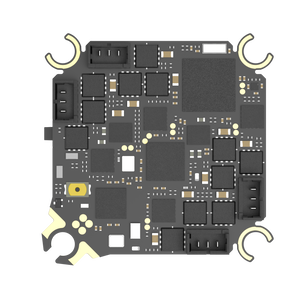
22 mm×17 mm×2.6 mm

Get a free quote

Product overview

The VLG V1831-012-A-01 combines a dual-frequency, multi-mode positioning antenna, an MTK 3335 positioning module and a six-axis gyroscope inertial navigation module in a GNSS receiver supplied with a 4 meters cable. It supports Beidou, GPS, GLONASS, Galileo and QZSS satellite signals simultaneously. Automatic switching between satellite and inertial navigation supports sub-meter positioning through tunnels and underground parking lots, while drift-signal filtering supports positioning in urban canyons and shaded environments.

Designed for high-precision positioning and navigation, the receiver serves applications including drones, robots, unmanned ships, low-speed unmanned vehicles and commercial vehicle fleets. Its inertial navigation algorithm outputs three-dimensional vehicle attitude and records driving events such as rapid acceleration, sharp turns, collisions and rollover. Additional applications include vehicle positioning in ports and warehouses, low-speed automatic driving and automatic parking. GNSS operation has a maximum speed of 515m/s and an altitude limit of 18000M; the operating temperature range is -35°C to +85°C.
Flight control & navigation

Specifications

VLG V1831-012-A-01 specifications
SpecificationValue & conditions
ModelVLG V1831-012-A-01 — GNSS Receiver with Inbuilt Antenna+RTK+Inertial System
Integrated equipment and supplied cableMulti-band, multi-mode positioning antenna; MTK 3335 sub-meter positioning module; six-axis gyroscope inertial navigation module; 4 meters cable
GNSS engine135 channels and DSP accelerator
GNSS signals
  • GPS/QZSS: L1 C/A, L1C, L5;
  • BDS: B1C, B1I, B2I;
  • GLONASS: L1;
  • Galileo: E1, E5;
  • SBAS: WAAS, EGNOS, MSAS, GAGAN, SDCM
Positioning precision
  • GNSS: less than 1m CEP;
  • SBAS: less than 1m CEP;
  • D-GNSS: less than 2.5cm CEP
GNSS, SBAS and D-GNSS positioning modes, respectively; CEP.
GNSS operating limitsMaximum speed: 515m/s; altitude: 18000MGNSS operation.
Position accuracy without GNSSLess than 1mWithout GNSS; horizontal position; CEP.
Attitude accuracy
  • Heading: 0.3°;
  • pitch: 0.4°;
  • roll: 0.5°
RMS.
Angular velocity accuracy0.1/sRMS.
Speed accuracy0.2m/sRMS.
Gyroscope
  • Range: ±250°/s;
  • scale factor: ±0.2%;
  • angle random walk: 0.45/h
Accelerometer
  • Range: ±8g;
  • zero bias stability: 5mg;
  • scale factor: ±0.2%
Digital interfaceUART-TTL / IIC; baud rate: 115,200 BPS
Data update frequency3hz
Data sampling frequency100hz
Power supply3.0 V to 3.6 VINS parameters.
Current consumption60 mAINS parameters.
Operating temperature-35°C to +85°C
Dimensions22mm×17mm×2.6mmINS parameters.
Frequency bandsGPS L1/L5; BDS B1/B2; GLONASS L1Antenna.
PolarizationRight-hand circular polarizationAntenna.
Gain and beam widthGain: ≥4.0 dBi; beam width: ≥120°Antenna; gain at 90° elevation; beam width at -1dB.
Axial ratio≤3dBAntenna.
LNA gain22±2dBAntenna.
In-band flatness±2dBAntenna.
V.S.W.RLess than 3.0dBAntenna.
Noise figureLess than 2.0Antenna.
DC voltage3.0-5.0VAntenna.
CurrentLess than 40mAAntenna.
Impedance50ΩAntenna.

Related guides