Product overview
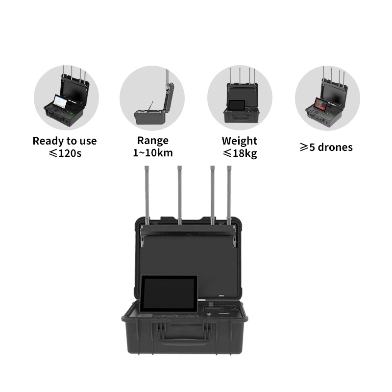
The Tatusky Technology Co., Ltd TTSKC01 combines drone detection, identification and tracking in a portable briefcase-style monitoring system. It is intended for rapid deployment in mobile or fixed security operations, with a ready-to-use deployment time of ≤120 s. Offline and online operation, multi-device networking and real-time trajectory mapping support monitoring and recording UAV activity. Applications include large events and public gatherings, VIP protection, airport and restricted-area monitoring, border and port patrols, and critical infrastructure protection.
Supported drones include DJI, AUTEL, FIMI, DAHUA, PowerVision, YUNEEC, UDIRC, FPV and Wi-Fi types; the locatable-model list names DJI Mavic, Air, Mini, FPV and Avata. The five operating bands are 900 MHz, 1.2 GHz, 2.4 GHz, 5.2 GHz and 5.8 GHz. Detection radius is 1–10 km, varying with environment and drone model, with an altitude range of 0–1000 m. Simultaneous tracking covers ≥5 drones, with 4–6 s data updates, ≤1.5° RMS azimuth error and ≤10 m location accuracy.
Specifications
| Specification | Value & conditions |
|---|---|
| Product configuration | TTSKC01 portable briefcase-style UAV monitoring system for mobile or fixed security operations |
| Detection range | 1–10 km radiusVaries with environment & drone model. |
| Detectable models | DJI Mavic, Air, Mini, FPV, Avata |
| Frequency bands | 900 MHz / 1.2 GHz / 2.4 GHz / 5.2 GHz / 5.8 GHz |
| Tracking accuracy | ≤10m location error |
| Drone swarm detection | ≥5 drones simultaneously |
| Weight | 18 kg |
| Display | 10.1" Touch Screen (1920×1200, 500 cd/m²) |
| Battery life | ≥4 hours |
| Waterproof rating | IP65 (case closed)Case closed. |
| Power | ≤100W |
| Operating temperature | -20°C to +65°C |
| Detection frequency bands | 900M / 1.2G / 2.4G / 5.2G / 5.8GHz |
| Detection distance | Coverage: 10 km |
| Simultaneous detection capability | ≥5 drones |
| Identification and pilot localization | Real-time UAV detection, drone identification and pilot localization within a 10 km range |
| Deployment modes | Offline or networked operation for large-area monitoring |
| Additional detection categories | DJI, AUTEL, FPV and Wi-Fi drones |
| Mapping and tracking | Real-time GIS map display and trajectory tracking |
| Drone classification | Distinguishes cooperative and hostile drones |
| Intrusion alerts | Visual and audible intrusion alerts |
| Data functions | Data playback, report statistics and visualization |
| Readiness time | Ready in 2 minutes |
| Supported drone brands | DJI, AUTEL, FIMI, DAHUA, PowerVision, YUNEEC, UDIRC, FPV, Wi-Fi drones |
| Locatable drone models | DJI Mavic, Air, Mini, FPV, Avata |
| Altitude range | 0–1000 m |
| Swarm detection | ≥5 dronesSimultaneous tracking. |
| Refresh rate | 4–6 s |
| Azimuth error | ≤1.5° (RMS)RMS. |
| Location accuracy | ≤10 m |
| Deployment time | ≤120 s to ready-to-use |
| Networking and activity recording | Offline and online operation, multi-device networking, real-time drone trajectory mapping, and UAV activity monitoring and recording |
| Intended applications | Large-event and public-gathering security; VIP protection and secret service missions; airport and restricted-area monitoring; border and port security patrols; critical infrastructure protection |