ChinaDroneRequest a quote →
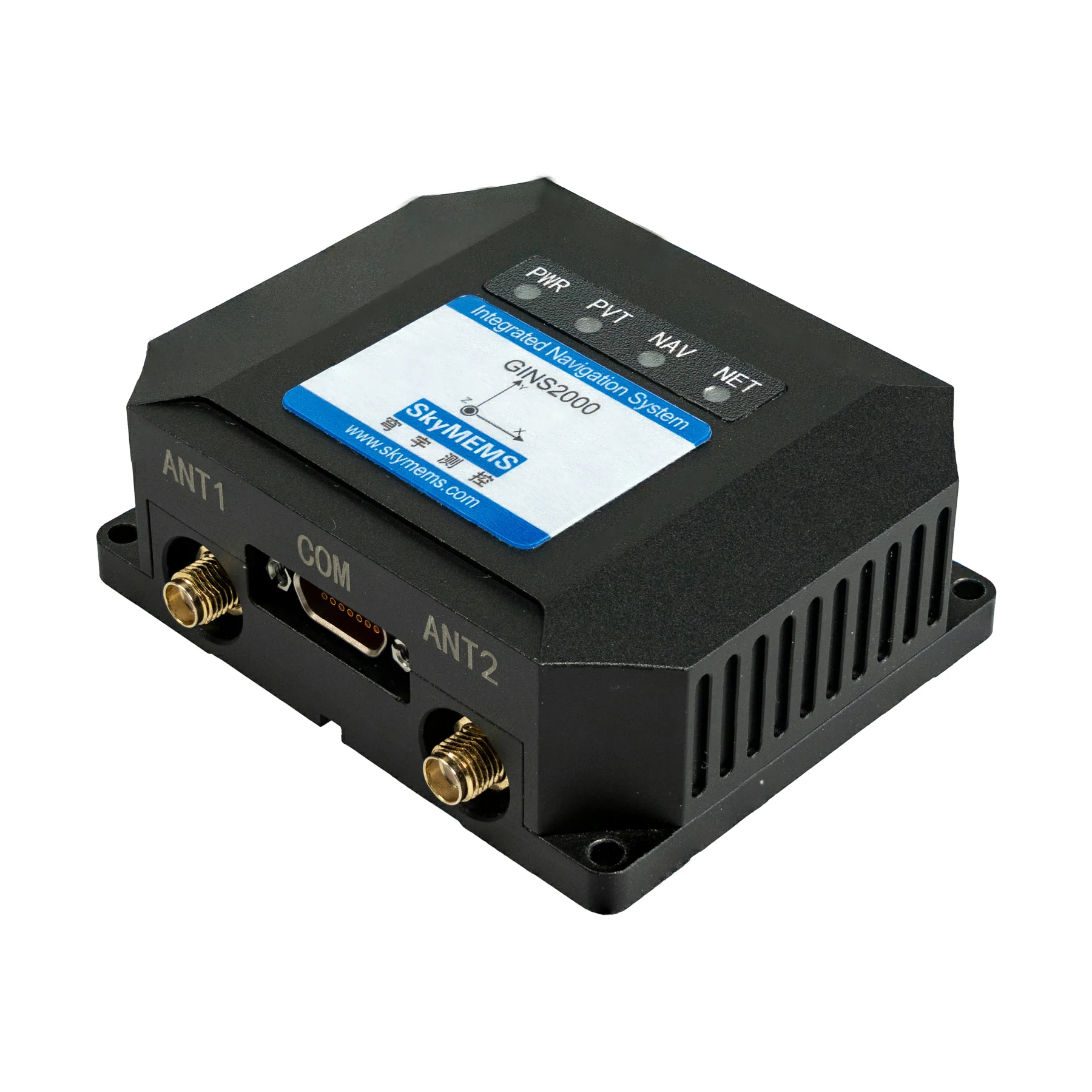
SkyMEMS GINS2000 integrated navigation system with black housing, two antenna connectors and a COM portSkyMEMS GINS2000 integrated navigation system with black housing, two antenna connectors and a COM port

SkyMEMS GINS2000 High-Performance Integrated Navigation System

The SkyMEMS GINS2000 is a high-performance GNSS/INS integrated navigation system combining MEMS inertial components with an RTK-enabled GNSS receiver. Designed for UAVs, vehicles and marine applications, it delivers navigation and attitude information through RS422 and RS232 interfaces in a compact, vibration-resistant unit.

SkyMEMSDrone flight controller
Applications
UAVs, ground vehicles, surface vessels, ships and precision agriculture
Supply voltage
9~36 V
Weight
Less than 150 g
Size
77*62*27.75 mm

Get a free quote

Product overview

The SkyMEMS GINS2000 combines high-precision MEMS inertial components with an RTK-enabled GNSS receiver module. Its proprietary navigation fusion algorithm and multiple compensation techniques support high-sensitivity signal tracking and positioning in harsh environments. The receiver supports BDS, GPS, GLONASS, Galileo and QZSS frequencies. Applications include UAV navigation, ground vehicles, surface vessels, ships and precision agriculture. Installed on a carrier and used with a GNSS antenna, the system provides position, speed, heading, pitch, roll, angular velocity and acceleration information.

The compact unit measures 77*62*27.75 mm and weighs less than 150 g, with strong vibration and shock resistance. It accepts a 9~36 V supply, consumes ≤3 W and operates from -40 to +80 °C. RS422 and RS232 interfaces provide connectivity, with a 100 Hz output rate and a default RS422 baud rate of 921600 bps. UART output is configurable through the host software; rates above 100Hz are available through factory configuration. Bandwidth and protocol are adjustable, and ODM customization is supported.
Flight control & navigation

Specifications

SkyMEMS GINS2000 High-Performance Integrated Navigation System specifications
SpecificationValue & conditions
ProductSkyMEMS GINS2000 High-Performance Integrated Navigation System
Integrated componentsHigh-precision MEMS inertial components and an RTK-enabled GNSS receiver module
Navigation processingSkyMEMS proprietary integrated navigation fusion algorithm with multiple compensation techniques
ApplicationsUAVs, ground vehicles, surface vessels, ships and precision agriculture
Navigation outputsPosition (longitude, latitude, altitude), speed, attitude (heading, pitch, roll), angular velocity and accelerationInstalled on a carrier and used with a GNSS antenna.
Heading accuracy0.1°1σ; 1m base line.
Position accuracy1.5 m1σ; SPP.
Heading drift0.15°GNSS-denied; 1 minute.
Gyroscope range±450 °/s
Gyroscope bias stability5 °/hAllan.
Gyroscope scale factor non-linearity100 ppm
Gyroscope random walk0.2 °/√h
Accelerometer range±16 g
Accelerometer bias stability50 ugAllan.
Accelerometer scale factor non-linearity0.01 %FS
Accelerometer random walk0.015 m/s/√h
GNSS receiver frequencies
  • BDS: B1I, B2I, B3I;
  • GPS: L1C/A, L2P (Y)/L2C, L5;
  • GLONASS: G1, G2;
  • Galileo: E1, E5a, E5b;
  • QZSS: L1, L2, L5
Supply voltage9~36 V
Power consumption≤3 W
Size77*62*27.75 mm
WeightLess than 150 g
InterfacesRS422, RS232
Output rate100 Hz
Baud rate921600 bpsDefault RS422.
Operating temperature-40 ~ +80 °C
Storage temperature-50 ~ +85 °C
Mechanical resistanceStrong vibration and shock resistance
Configuration optionsAdjustable bandwidth and protocol; ODM supported
UART output configurationTypically 100Hz; configurable through GINS2000 host software, with factory configuration available above 100HzUART output; rates above 100Hz require factory configuration.

Related guides