ChinaDroneRequest a quote →

RTK GNSS Board MP-357

The MoneyPro RTK GNSS Board MP-357 is a compact, low-power positioning module combining RTK technology with six-constellation GNSS support for centimeter-level accuracy. USB-C and Ethernet interfaces support host-system integration for applications including infrastructure mapping, precision robotics, autonomous maritime navigation, tracking, and car navigation.

MoneyProDrone GPS
Positioning accuracy
Centimeter-level positioning accuracy
Supported constellations
GPS, GLONASS, Beidou, Galileo, QZSS, and NavIC

Get a free quote

Product overview

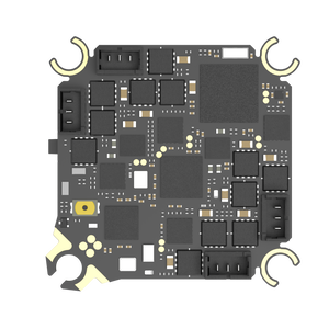
The MoneyPro RTK GNSS Board MP-357 is a high-precision positioning module combining Real-Time Kinematic technology with support for GPS, GLONASS, Beidou, Galileo, QZSS, and NavIC. It delivers centimeter-level positioning for location-critical applications, including smart city infrastructure mapping, precision robotics, and autonomous maritime navigation. Its compact, low-power board design accommodates space-constrained devices while reducing energy consumption, and high-speed data interfaces including USB-C and Ethernet provide connections to modern host systems.

Enhanced signal processing supports positioning in challenging environments, including dense urban canyons and remote rural areas with weak satellite signals. The MP-357 also serves Internet of Things trackers, car navigation, and wearables. Onboard indicators communicate data output and positioning status: the blue TX light flashes when the device is powered on to indicate data output. The PPS light stays off before positioning begins and starts flashing after 3D positioning is achieved.
Flight control & navigation

Specifications

RTK GNSS Board MP-357 specifications
SpecificationValue & conditions
Product typeRTK GNSS Board MP-357 high-precision positioning module
Positioning technologyReal-Time Kinematic (RTK) with multi-constellation GNSS support
Supported constellationsGPS, GLONASS, Beidou, Galileo, QZSS, and NavIC
Positioning accuracyCentimeter-level positioning accuracy
Board designCompact, low-power design for space-constrained devices
Data interfacesHigh-speed data interfaces including USB-C and Ethernet
Signal processingEnhanced signal processing algorithms support reliable positioningDense urban canyons or remote rural areas with weak satellite signals.
ApplicationsSmart city infrastructure mapping, precision robotics, and autonomous maritime navigation
Additional applicationsInternet of Things trackers, car navigation, and wearables
TX indicatorFlashing blue light indicates data outputWhen the device is powered on.
PPS indicatorOff before positioning is initiated; flashes after 3D positioning is achievedBefore positioning is initiated; after 3D positioning is achieved.

Related guides