ChinaDroneRequest a quote →

MoneyPro RTK GNSS Antenna MT-380B

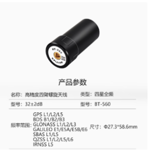
The MoneyPro RTK GNSS Antenna MT-380B brings full-frequency, four-constellation reception to reference station positioning. Integrated RTK provides centimeter-level accuracy for surveying, navigation, agriculture, and monitoring work. Its robust construction can be configured with anti-interference and weather-resistant options.

MoneyProDrone GPS
Positioning accuracy
Centimeter-level

Get a free quote

Product overview

The MoneyPro RTK GNSS Antenna MT-380B serves reference stations requiring full-frequency reception across four satellite constellations: GPS, GLONASS, BeiDou, and Galileo. Its integrated Real-Time Kinematic technology provides positioning accuracy at the centimeter level. Combining high gain with precise reception and high reliability, the antenna supports stable signal acquisition in complex environments and works with most mainstream satellite navigation receivers.

A robust structure accommodates field use outdoors and demanding working environments. Anti-interference and weather-resistant options are available, alongside special-grade configurations tailored to application requirements. The MT-380B supports surveying for geodesy and waterways, agricultural precision work, and marine navigation. Its uses also extend to mapping channels, monitoring deformation, and monitoring geological disasters.
Flight control & navigation

Specifications

MoneyPro RTK GNSS Antenna MT-380B specifications
SpecificationValue & conditions
Product typeFour-constellation, full-frequency reference station antenna
Supported satellite systemsGPS, GLONASS, BeiDou, and Galileo
Positioning accuracyCentimeter-levelWith integrated RTK (Real-Time Kinematic) technology.
Antenna characteristicsHigh gain, high precision, multi-system compatibility, and high reliability
Structural designRobust structural design
Protection optionsAnti-interference and weather-resistant performanceOptional configurations.
Receiver compatibilityCompatible with most mainstream satellite navigation receivers
ApplicationsGeodetic surveying, waterway surveying and mapping, precision agriculture, deformation monitoring, and geological disaster monitoring
Marine applicationMarine navigation and channel mapping
Special configurationsSpecial-grade configurations availableBased on specific application requirements.

Related guides