Product overview
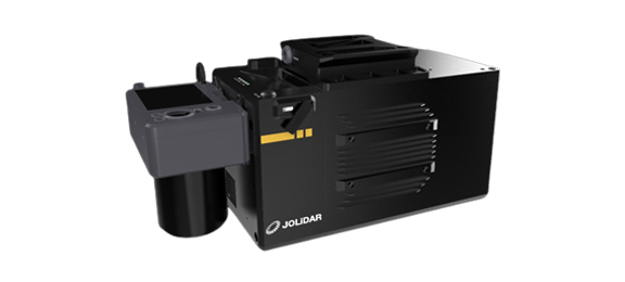
The JOUAV JoLiDAR-LR22 is an airborne LiDAR payload for professional surveying and mapping of large areas and complex terrain. It combines a laser scanner, Honeywell HG-4930 IMU, RGB imaging and data acquisition. Civilian applications include ecological research, forest monitoring, road construction, mining and aggregates, and power line inspection. Its 360° field of view and up to 15 returns per laser pulse support measurements across vegetation layers. Compatible aircraft include the CW-25E, PH-20 and CW-30E.
Maximum scanning distance is 1845m at target reflectivity of at least 80%, while minimum scanning distance is 1.5m at a pulse repetition rate of at least 1MHz. Maximum effective measurement rate is 1.5 million points per second, with whole-system scanning accuracy of ≤3cm vertically and ≤5cm horizontally. Single-strip density includes 70 points/m² at 150m flight height and 1500kHz scanning frequency, or 20 points/m² at 300m and 800kHz. All published performance figures are theoretical values from JOUAV internal testing under particular conditions; actual results vary with product configuration, software version, application conditions and environment.
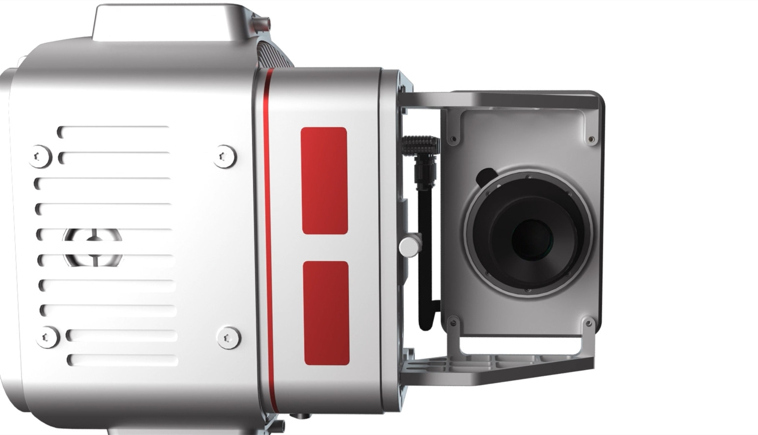
The integrated CA103 camera pairs a 61MP, 35.7 × 23.8mm full-frame sensor with a 21mm lens to capture imagery alongside laser measurements. Data acquisition synchronizes positioning, scanner and camera data with an error below 1ms and uses a 1T SSD for storage. GNSS/INS processing supports post-event differential and precision single-point post-processing. Aircraft installation uses a vibration damping mount and requires an 11–34V supply, with typical system consumption of 65W. The payload measures 323 × 209 × 129mm and weighs 5.4kg, or 4.5kg without the camera.
Specifications
| Specification | Value & conditions |
|---|---|
| Product identity and purpose | JOUAV JoLiDAR-LR22 LiDAR system; airborne scanning payload for professional UAV applications. |
| Integrated architecture | Laser scanner, IMU, RGB imaging and data acquisition.An integrated payload. |
| Laser head distance measurement accuracy | 15mm repetition accuracy.Repetition accuracy. Published performance is theoretical and depends on configuration and operating conditions. |
| Scanning distance | Maximum 1845m; minimum 1.5m.Maximum at reflectivity ρ≥80%; minimum at PRR≥1MHZ. Published performance is theoretical and condition-dependent. |
| Laser divergence | 0.5mrad. |
| Laser wavelength and safety classification | Near infrared, 1550 nm; Class 1 (eye safe).Classification. |
| Laser pulse frequency | ≥1500KHZ.Published performance is theoretical and depends on configuration and operating conditions. |
| Maximum echo quantity | 15.Maximum echo quantity; published performance is theoretical and condition-dependent. |
| Angular resolution | ≤0.001°.Published performance is theoretical and depends on configuration and operating conditions. |
| Effective measurement rate | Maximum 1.5 million points/sec.Maximum effective rate; published performance is theoretical and condition-dependent. |
| IMU type | Honeywell HG-4930. |
| POS inertial specifications | Gyro zero bias stability 0.25°/hr; acceleration range ±20g; update frequency 100-600Hz.Published performance is theoretical and depends on configuration and operating conditions. |
| Positioning system mode | Support Samsung system data, GPS L1/L2, GLONASS G1/G2, Beidou B1/B2.The manufacturer's system-mode wording is reproduced as published; confirm its intended meaning and the selected configuration. |
| Post POS positioning accuracy | Horizontal ≤0.01m; vertical ≤0.02m.Post POS accuracy; published performance is theoretical and depends on configuration and operating conditions. |
| Post POS attitude accuracy | Heading ≤0.010°; pitch/roll ≤0.005°.Post POS accuracy; published performance is theoretical and depends on configuration and operating conditions. |
| GNSS/INS processing | Supports post-event differential and precision single-point post-processing. |
| RGB camera type and weight | CA103; 0.42kg.Camera subsystem values, rather than complete payload weight. |
| RGB camera imaging specifications | 61MP; 9504*6336 resolution; 35.7×23.8mm sensor; 21mm focal length.Camera sensor specifications. |
| Time synchronization | Synchronization error less than 1ms.Synchronization between POS, laser scanner and camera acquisition; published performance is theoretical and condition-dependent. |
| Storage control | Independent button control of scanner, storage module and POS; network-port and other data-download methods.Control and download capabilities. |
| Storage and transfer speeds | 1T SSD; write speed ≥100 MByte/s; read speed ≥100 MByte/s.Capacity and transfer rates. |
| Overall scanning accuracy | Vertical ≤3cm; horizontal ≤5cm.Whole-system scanning accuracy. Published performance is theoretical and depends on configuration and operating conditions. |
| Point cloud density | 70 points/m2 at 150m and 1500Khz; 40 points/m2 at 200m and 1200Khz; 20 points/m2 at 300m and 800Khz; 10 points/m2 at 400m and 600Khz; 6 points/m2 at 500m and 400Khz.Single airband; each density is tied to its stated flight height or altitude and scanning frequency. Published performance is theoretical and condition-dependent. |
| Vibration damping | Vibration damping device fixed to the UAV.Mounting description; confirm the selected aircraft installation. |
| Field of view | 360°. |
| Electrical requirements | 11-34V supply; 65W typical system consumption.Power consumption is a typical value. And aircraft power provision. |
| System weight | 5.4kg; 4.5kg without camera.5.4kg published system weight; 4.5kg explicitly excludes the camera. |
| System dimensions | 323mm×209mm×129mm.Published dimensions are subject to configuration and actual-usage qualification. |
| Elevation error without GCPs | Less than 2cm without ground control points.Claim specifically concerns elevation error without ground control points; it is distinct from the whole-system scanning accuracy specification and remains subject to the manufacturer's performance qualification. |
| Performance limitations | Actual performance varies with product configuration, software version, application conditions and environment; all data is subject to actual usage.Applies to all published performance data; values are theoretical results from internal testing under particular conditions. |
Request a quote for JOUAV JoLiDAR-LR22 LiDAR system
Send your application, destination country and expected quantity to the ChinaDrone team. We can discuss product selection, configuration and sourcing from China.
Submit your procurement requirements ↗No account needed. A model number is optional. Your enquiry is handled by ChinaDrone.