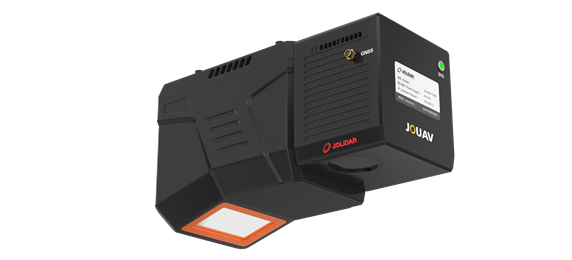
Product overview
The JoLiDAR-120G collects point clouds for terrain mapping using laser scanning and multi-echo processing.
Its processing of multiple returns supports mapping the ground beneath tree canopies, with applications in forestry, environmental studies and land-use planning.
The system integrates with JOUAV's flight control system and ground control station for workflow management and real-time control.
JOUAV describes its published performance data as theoretical values from internal laboratory tests under particular conditions. Actual performance can vary with configuration, software, application conditions and the environment.
Tell us the specifications you need. We can discuss the exact model and configuration for your project.
Request a quote for JOUAV JoLiDAR-120G LiDAR System
Send your application, destination country and expected quantity to the ChinaDrone team. We can discuss product selection, configuration and sourcing from China.
Submit your procurement requirements ↗No account needed. A model number is optional. Your enquiry is handled by ChinaDrone.