Product overview
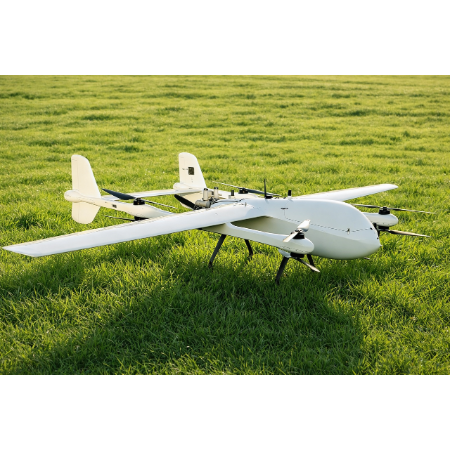
Feima Robotics independently developed the V600 for applications including topographic surveying, terrain modeling, emergency monitoring, ecological remote sensing and engineering inspection.
A high-precision differential GNSS board is standard equipment. It supports PPK, RTK and integrated positioning modes, while POS-assisted aerial triangulation supports mapping without ground control points.
The aircraft supports terrain-following flight, automatically adjusting its altitude to changes in the survey area's topography.
The V600 supports a range of Feima Robotics remote sensing and mapping payloads. Its airframe uses a foldable design with tool-free installation and removal.
Specifications
| Specification | Value & conditions |
|---|---|
| Model | V600 |
| Flight endurance | 3hWith 1 kg payload. |
Request a quote for Feima Robotics V600
Send your application, destination country and expected quantity to the ChinaDrone team. We can discuss product selection, configuration and sourcing from China.
Submit your procurement requirements ↗No account needed. A model number is optional. Your enquiry is handled by ChinaDrone.