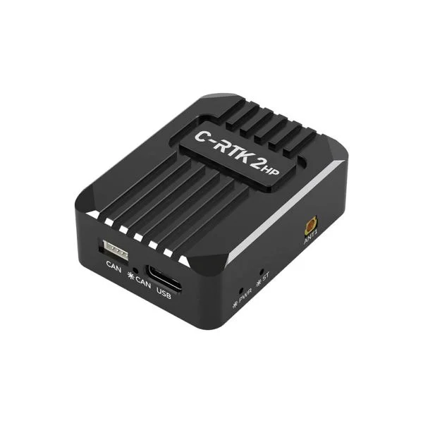
Product overview
The CUAV C-RTK 2HP provides positioning and heading for unmanned systems through a single module with dual-antenna reception. Its hardware combines an STM32F4 processor, a 1408-channel multi-constellation, multi-frequency receiver and an industrial-grade RM3100 electronic compass. Two antenna connections accommodate the primary and secondary antenna roles, which have different frequency coverage. Dual-antenna heading can replace electronic-compass heading, while the integrated RM3100 can serve as a redundant reference when the module is installed away from interference.
The receiver supports GPS, BDS, GLONASS, Galileo and QZSS, with Dronecan/NMEA data protocols and RTCM3.X differential corrections. Positioning accuracy varies by mode: single-point operation provides horizontal accuracy of 1.5M and elevation accuracy of 2.5m, while RTK provides 0.8cm+1PPM horizontally and 1.5cm+1PPM in elevation. Data refresh defaults to 5Hz and reaches a maximum of 20Hz. Position acquisition takes under 30S from a cold start or under 5s with assistance; convergence is approximately 18s.
Specifications
| Specification | Value & conditions |
|---|---|
| Product identity and type | CUAV C-RTK 2HP dual-antenna heading RTK module |
| Processor | STM32F4 |
| Positioning architecture | Multi-constellation, multi-frequency, dual-antenna positioning module |
| Electronic compass | RM3100 |
| Receiver channels | 1408 channels |
| Satellite systems | GPS, BDS, GLONASS, Galileo and QZSS |
| Primary antenna frequency support |
|
| Secondary antenna frequency support |
|
| Single-point positioning accuracy | Horizontal: 1.5M; elevation: 2.5mSingle-point positioning. |
| DGPS positioning accuracy | Horizontal: 0.4M+1PPM; elevation: 0.8m+1PPMDGPS assisted positioning. |
| RTK positioning accuracy | Horizontal: 0.8cm+1PPM; elevation: 1.5cm+1PPMRTK positioning. |
| Maximum satellite acquisition capacity | Single-point: 28+; RTK: 50+Single-point positioning or RTK, respectively. |
| Position acquisition time | Cold start: less than 30S; assisted start: less than 5sCold start or assisted start, respectively. |
| Data refresh rate | 5Hz default; maximum 20Hz |
| Differential correction format | RTCM3.X |
| Data protocols | Dronecan/NMEA |
| Antenna connections | 2 antenna connections |
| Convergence time | Approximately 18s |
| Satellite count | 28 satellites |
| Heading function | Provides heading for unmanned systems and can replace electronic-compass headingOne module with dual-antenna reception. |
| Redundant compass integration | Built-in industrial-grade RM3100 sensor can provide a redundant backup sourceModule installed away from interference. |
Request a quote for CUAV C-RTK 2HP
Send your application, destination country and expected quantity to the ChinaDrone team. We can discuss product selection, configuration and sourcing from China.
Submit your procurement requirements ↗No account needed. A model number is optional. Your enquiry is handled by ChinaDrone.