ChinaDroneRequest a quote →

Beitian BT-940DB

The Beitian BT-940DB is an RTK high-precision GNSS receiver for deformation monitoring with an integrated radio and IMU. Its Φ140*59.5mm body uses a GX12-4 aviation connector. Multi-constellation signal support, static differential positioning, PPP and RTK positioning combine with LoRa wireless data transmission.

BeitianDrone flight controller
Supply voltage
DC 3.6 V-6.0 V; typical: 5.0 V
Weight
≤550g
Dimensions
Φ140*59.5 mm

Get a free quote

Product overview

The Beitian BT-940DB is an RTK high-precision GNSS receiver for deformation monitoring, combining satellite positioning with an integrated radio. Its signal support spans GPS, BDS-2, BDS-3, GLONASS, Galileo and QZSS, alongside SBAS and version-dependent IRNSS support. Static differential positioning is supported with Compass Solution software, while PPP positioning provides horizontal accuracy of 0.1m and vertical accuracy of 0.2m. The integrated IMU incorporates a gyroscope and an accelerometer.

The receiver measures Φ140*59.5mm, weighs ≤550g and uses a GX12-4 aviation connector. It operates from a DC 3.6V-6.0V supply, with a typical voltage of 5.0V, across an operating temperature range of -40°C to +85°C. Its integrated LoRa data module operates at 470MHz-510MHz, with a transmission distance of 2000m at 115200 bps. The module uses TTL transmitter and receiver levels and supports an air data rate of 1.2kbps-62.5kbps.
Flight control & navigation

Specifications

Beitian BT-940DB specifications
SpecificationValue & conditions
ProductBeitian BT-940DB RTK high-precision GNSS receiver for deformation monitoring, with integrated radio.
DimensionsΦ140*59.5mm
Supply voltageDC 3.6V-6.0V; typical: 5.0V
ConnectorGX12-4 aviation connector
Wireless data moduleLoRa; operating frequency 470MHz-510MHz; transmission distance 2000m at 115200 bps; transmitter and receiver levels TTL; air data rate 1.2kbps-62.5kbps.Transmission distance at 115200 bps.
Operating temperature-40°C ~ +85°C
Weight≤550g
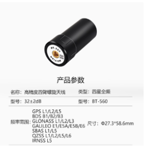
GPS signalsL1C/A, L2P, L2C, L5, L1C
BDS-2 signalsB1I, B2I, B3I
BDS-3 signalsB1I, B1C, B2a, B2b, B3I
GLONASS signalsG1, G2, G3*Starred signals are subject to adjustment by version.
Galileo signalsE1, E5b, E5a, E5 AltBoC*, E6c*Starred signals are subject to adjustment by version.
QZSS signalsL1C/A, L2C, L5, L1C
SBAS signalsL1C/A, L5
IRNSS* signalsL5Starred items are subject to adjustment by version.
Static differential horizontal accuracy±(2.5+1×10⁻⁶×D) mmStatic differential positioning with Compass Solution software support; D is baseline distance in km.
Static differential vertical accuracy±(5.0+1×10⁻⁶×D) mmStatic differential positioning with Compass Solution software support; D is baseline distance in km.
PPP horizontal accuracy0.1mPPP positioning.
PPP vertical accuracy0.2mPPP positioning.
RTK horizontal accuracy± (8+ 10-6 × D) mmRTK positioning; D is baseline length in km.
RTK vertical accuracy± (15+ 10-6× D) mmRTK positioning; D is baseline length in km.
Gyroscope range±125°/sGyroscope.
Gyroscope bias repeatability0.5°/sGyroscope.
Gyroscope bias stability5°/hGyroscope.
Angular random walk0.12°/sqrt(h)Gyroscope.
Accelerometer range±2gAccelerometer.
Accelerometer bias repeatability20mgAccelerometer.
Accelerometer bias stability50ugAccelerometer.
Velocity random walk0.07m/s/sqrt(h)Accelerometer.
MSM3~MSM7 messages1073~1077, 1083~1087, 1123~1127, 1093~1097RTCM 3.X output format.

Related guides