ChinaDroneRequest a quote →
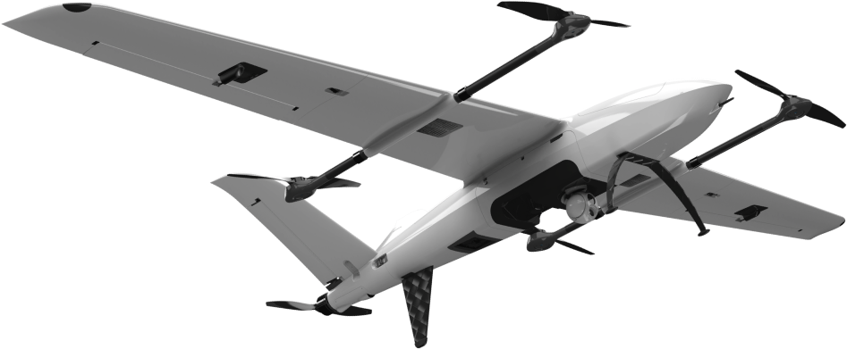
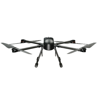
TUSUAV ZT-25V fixed-wing VTOL drone with landing gear and an underside camera payloadTUSUAV ZT-25V fixed-wing VTOL drone with landing gear and an underside camera payload

TUSUAV ZT-25V

The TUSUAV ZT-25V is an all-electric, long-endurance vertical take-off and landing fixed-wing UAV for patrol, inspection and mapping. Its modular payload architecture supports loads up to 10 kg. Integrated avionics, triple-redundant flight control, DSM-based obstacle avoidance and video-guided landing support operations, with mission payload options spanning imaging, lidar, loudspeakers and environmental sensing.

TUSUAVInspection drone
Payload capacity
Up to 10 kg.
Wind resistance
Force 7.

Get a free quote

Product overview

The TUSUAV ZT-25V combines all-electric propulsion with a vertical take-off and landing fixed-wing configuration for long-endurance patrol, inspection and mapping missions. Its modular payload architecture carries up to 10 kg and accommodates loudspeakers, electro-optical gimbals, lidar and mapping cameras, with expandable support for multispectral sensing and gas detection. The effective operating radius is customizable. Cruise wind resistance reaches Force 7, while rain capability includes extended flight in light rain, at least 3 hours per flight in moderate rain and at least 1 hour per flight in heavy rain.

Highly integrated four-in-one avionics, dual-antenna differential heading and triple-redundant flight control support flight operations. Proprietary sensors and closed-loop attitude algorithms enable heading- and gimbal-based navigation during jamming or spoofing without relying on satellite positioning. DSM-CAS plans three-dimensional obstacle-avoidance routes using aircraft dynamics and onboard digital surface data covering China; an optional upgrade provides DSM accuracy up to 0.5 m. For landing, the onboard three-axis gimbal points downward, enabling AI detection of unexpected people and vehicles. Operators can adjust the landing target by dragging the ground marker in the video-guided landing interface.

Augmented-reality video overlays combine loaded KML targets with DSM calibration to display roads, towers, lines, buildings and ground police deployment. Moving-platform take-off and landing add operational flexibility. With an additional airborne relay aircraft, video passes from the mission aircraft through the relay to the ground, providing 50–100 km effective coverage in mountainous terrain. The cloud patrol system manages equipment, personnel, routes, missions, data and flight-restriction unlocking workflows, while supporting HD live streaming, video distribution, air–ground coordination and two-way interaction.
Surveying & inspection

Specifications

TUSUAV ZT-25V specifications
SpecificationValue & conditions
Product typeLong-endurance electric vertical take-off and landing fixed-wing UAV.
Operating radiusCustomizable effective operating radius.
Payload architectureModular payloads.
Wind resistanceForce 7.During cruise.
Light-rain operationExtended flight.In light rain.
Moderate-rain operation≥3 hours.In moderate rain, per flight.
Heavy-rain operation≥1 hour.In heavy rain, per flight.
Heading technologyDual-antenna differential heading.
AvionicsHighly integrated four-in-one avionics system.
Flight-control redundancyTriple-redundant flight control.
Navigation resilienceProprietary sensors and closed-loop attitude algorithms support heading- and gimbal-based navigation without satellite positioning, allowing continued patrol missions and return flight.Under jamming or spoofing.
DSM-CAS collision avoidanceThree-dimensional obstacle-avoidance path planning based on aircraft dynamics and a digital surface model.
Onboard terrain dataIntegrated onboard DSM data covering China.
Optional DSM accuracyDSM accuracy up to 0.5 m.With a DSM upgrade for special requirements.
Dynamic route planningReal-time route planning accounts for wind speed, turning radius, climb rate and maneuverability, with automatic adjustment of unsafe routes.
Augmented-reality video overlaysReal-time video overlays can display road networks, towers, lines, buildings and ground police deployment.With target KML loaded and calibrated using DSM data.
Video-guided landing equipmentAn onboard three-axis gimbal points vertically downward; AI detection supports avoidance of unexpected vehicles and people.During landing.
Landing-point adjustmentDrag the ground landing marker to adjust the target for video-guided precision landing.When adjusting the landing target.
Moving-platform operationTake-off and landing on moving platforms.
Airborne relay coverage50–100 km effective coverage, relaying video from the mission aircraft through the relay aircraft to the ground.In mountainous terrain, using an additional airborne relay aircraft.
Cloud operations managementCloud patrol system covering equipment, personnel, routes, missions, data and flight-restriction unlocking workflows.
Cloud communication functionsHD live streaming, video distribution, air–ground coordination and two-way interaction.
Payload capacityUp to 10 kg.
Supported mission payloadsLoudspeakers, electro-optical gimbals, lidar and mapping cameras, with expandable support for multispectral and gas-detection payloads.