ChinaDroneRequest a quote →

Flow Measurement Drone

The MoneyPro Flow Measurement Drone is a specialized UAV for measuring water velocity and discharge in rivers, canals, and reservoirs. It combines an acoustic Doppler current profiler, autonomous transect planning, and real-time flow reporting. Its nylon carbon fiber and aviation aluminum construction carries four rotors with 34-inch folding propellers.

MoneyProInspection drone
Maximum payload
10 kg
Wind resistance
≥6
Wheelbase
1400 mm

Get a free quote

Product overview

The MoneyPro Flow Measurement Drone integrates an acoustic Doppler current profiler (ADCP) with high-precision positioning systems to measure water velocity and discharge in rivers, canals, and reservoirs. Autonomous flight planning supports systematic transect surveys, while real-time data processing produces flow reports for hydrological monitoring, flood forecasting, and water resource management. Its positioning system uses GPS/Beidou/Galileo/GLONASS, with positioning accuracy of ±0.5m. The hydrological monitoring platform supports both manual and automatic flow measurement.

Built from nylon carbon fiber with aviation aluminum, the aircraft has 4 rotors and 4 propellers, using 34-inch folding propellers. Its 1400mm wheelbase accompanies deployed dimensions of 1020*1020*750mm and folded dimensions of 640*640*750mm. Empty weight is 13kg, battery weight is 12.6kg, maximum payload is 10kg, and maximum takeoff weight is 36kg. Endurance is 61 minutes with no load and 34 minutes at full load. Maximum speed is 15m/s, with wind resistance of ≥6 and an IP65 enclosure rating.

The supplied equipment comprises a remote control, drone battery, charger, aircraft case, water level gauge, and hydrological monitoring platform. The platform transmits data in real time over 4G to the drone management platform. It supports cross-section route planning import, automatic water level measurement, flow velocity display, and flow calculation. Operators can display cross-section diagrams and areas, view historical flight data, and export flow reports. Map functions show routes and measurement points, with annotation and measurement of points, lines, and areas.
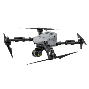
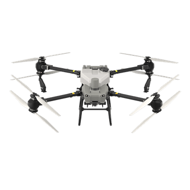
Surveying & inspection

Specifications

Flow Measurement Drone specifications
SpecificationValue & conditions
Product type and applicationFlow Measurement Drone; specialized UAV for water velocity and discharge measurement in rivers, canals, and reservoirs
Measurement equipmentIntegrated acoustic Doppler current profiler (ADCP) and high-precision positioning systems
Survey and reporting functionsAutonomous flight planning for systematic transect surveys; real-time data processing and flow reports for hydrological monitoring, flood forecasting, and water resource management
Included equipmentRemote control, drone battery, charger, aircraft case, water level gauge, hydrological monitoring platform
Product materialNylon carbon fiber with aviation aluminum
Propellers34-inch folding propellers
Number of rotors4 rotors, 4 propellers
Deployed dimensions1020*1020*750mmDeployed.
Folded dimensions640*640*750mmFolded.
Wheelbase1400mm
Empty weight13kgEmpty.
Battery weight12.6kg
Maximum payload10kg
Maximum takeoff weight36kg
No-load endurance61 minutesNo load.
Full-load endurance34 minutesFull load.
Maximum speed15m/s
Wind resistance≥6
Enclosure ratingIP65
Positioning systemGPS/Beidou/Galileo/GLONASS
Positioning accuracy±0.5m
Data transmission4G real-time data transmission to the drone management platformHydrological monitoring platform.
Cross-section measurement functionsCross-section route planning import, flow velocity display, automatic water level measurement, flow calculation, cross-section information input, and display of cross-section diagrams and areasHydrological monitoring platform.
Historical data and report exportHistorical flight data viewing and flow data report exportHydrological monitoring platform.
Map and annotation functionsReal-time map display of route information and flow measurement points; annotation and measurement of points, lines, and areasHydrological monitoring platform.
Measurement modes and flight monitoringManual and automatic flow measurement; waypoint planning, flight routes, cross-section vertical flight, and real-time display of drone position, monitoring data, and drone flight footageHydrological monitoring platform.