Product overview
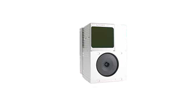
The Hi-Target ARS-450 is a lightweight LiDAR payload developed for multirotor UAV surveying. Its architecture combines laser ranging with an in-house inertial navigation system, with camera-equipped and camera-free configurations weighing 1.1kg and 0.9kg respectively. The camera configuration has 24 million pixels and a 16mm focal length. Integration provisions include adaptation to different UAV types and support for third-party custom development. System power consumption is 18W, and the equipment has an IP45 protection rating.
The ARS-450 supports real-time point-cloud viewing in true color or colored by reflectivity or elevation, with LAS/LAZ output for subsequent processing. Dedicated software supports data acquisition, processing, analysis and customized reporting, while a base-station-free operating mode expands deployment options. Range depends on target reflectivity and illumination: 450m applies at 80% reflectivity and 0 klx, falling to 190m at 10% reflectivity and 100klx. System accuracy is specified at 50m, with 10cm horizontal and 5cm elevation accuracy.
Specifications
| Specification | Value & conditions |
|---|---|
| Product type and integration | Lightweight LiDAR system developed for multirotor platforms, incorporating an in-house inertial navigation system. |
| Processing workflow | Supports real-time point-cloud display, incorporates Cloud Trace technology, and supports operation without a base station. Dedicated processing software supports acquisition, processing, analysis and customized reporting. |
| Configuration weights | 0.9kg without camera; 1.1kg with camera.Without camera; with camera. |
| Total system weight | ≤1.1kg |
| System power consumption | 18W |
| Ingress protection | IP45 |
| Measurement range | 450m at 80% reflectivity, 0 klx; 190m at 10% reflectivity, 100klx.80% reflectivity at 0 klx; 10% reflectivity at 100klx. |
| System accuracy | Horizontal accuracy: 10cm at 50m; elevation accuracy: 5cm at 50m.At 50m. |
| LiDAR ranging accuracy | 3cm at 100m.At 100m. |
| Point-cloud data rate | Single return: 140000pts/s; multiple returns: 720000pts/s.Single-return and multiple-return modes. |
| Real-time point-cloud visualization | Supports true color, reflectivity coloring and elevation coloring. |
| Inertial navigation heading accuracy | 0.038° |
| Inertial navigation pitch and roll accuracy | 0.01° |
| Laser safety class | Class1 |
| Inertial navigation IMU update frequency | 600Hz |
| Data output formats | LAS/LAZ |
| Camera resolution | 24 million pixels.Camera-equipped configuration. |
| Camera focal length | 16mmCamera-equipped configuration. |
| Point-cloud thickness | Ground point-cloud thickness better than 5cm, using the upgraded optimization algorithms in the in-house point-cloud processing software.Ground point cloud from a single flight line. |
| Platform adaptation and development | Supports adaptation to different UAV types and third-party custom development. |
Request a quote for Hi-Target ARS-450
Send your application, destination country and expected quantity to the ChinaDrone team. We can discuss product selection, configuration and sourcing from China.
Submit your procurement requirements ↗No account needed. A model number is optional. Your enquiry is handled by ChinaDrone.