ChinaDroneRequest a quote →
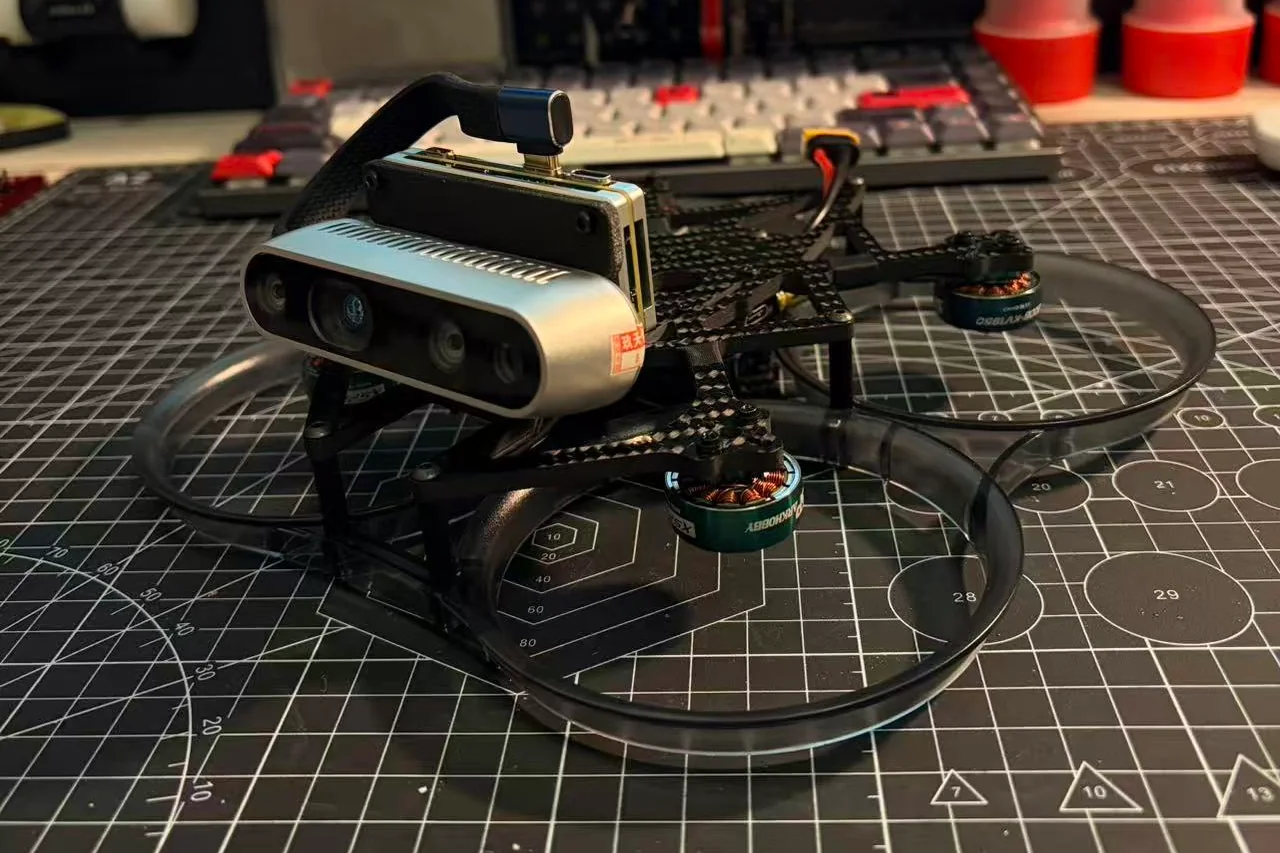
FUNSKII Argus 3.5-inch vision quadcopter with a front-mounted depth camera and propeller ductsFUNSKII Argus 3.5-inch vision quadcopter with a front-mounted depth camera and propeller ducts

FUNSKII Argus

The FUNSKII Argus is a 3.5-inch ducted quadcopter for visual navigation and perception research. It integrates an Intel RealSense D435 depth camera, Radxa Cubie A7Z onboard computer and PX4 flight control, with visual-inertial positioning and preinstalled ROS 1 Noetic software.

Flight time
32 minutes
Wheelbase
150 mm
Weight
374 g

Get a free quote

Product overview

The FUNSKII Argus combines a 3.5-inch ducted quadcopter body with onboard depth sensing and computing for visual navigation and perception research. Its Intel RealSense D435 depth camera sits on a bracket angled upward by 20°, with the Radxa Cubie A7Z computer mounted upright behind it. Visual-inertial odometry provides positioning without requiring LiDAR or GPS. The aircraft has a 150 mm wheelbase, weighs 374 g without a battery and has a take-off weight of 823 g with a battery.

Flight control uses a MicoAir743-AIO-35A all-in-one controller with BMI088 and BMI270 dual IMUs running PX4. The onboard computer comes with Ubuntu 20.04, ROS 1 Noetic and a visual-inertial localization program preinstalled. UAV Stack ground-station software is supplied with source code and supports connection, mapping, flight control, waypoint missions and YOLO recognition. Recommended payload is up to 500 g, hover endurance is 32 minutes, and horizontal and vertical hover accuracy is ±0.03 m.

OEM & customization

Specifications

FUNSKII Argus specifications
SpecificationValue & conditions
Model numberArgus
Product typeDucted quadcopter
Size class3.5-inch
Wheelbase150 mm
Weight374 gWithout battery.
Take-off weight823 gWith battery.
Recommended payloadUp to 500 g
Flight time32 minutesHover.
Hover accuracy±0.03 mHorizontal and vertical.
Flight controllerMicoAir743-AIO-35A
IMUBMI088 + BMI270 (dual IMU)
FirmwarePX4
LiDARNone
PositioningVisual-inertial odometry; no LiDAR or GPS required
Onboard computerRadxa Cubie A7Z
CameraIntel RealSense D435Mounted at a 20° upward angle.
Operating systemUbuntu 20.04
Robotics middlewareROS 1 Noetic
Preinstalled softwareUbuntu 20.04, ROS 1 Noetic and visual-inertial localization programPreinstalled on the onboard computer.
Ground stationUAV Stack, developed in-houseSource code supplied.
Ground-station functionsConnection, mapping, flight control, waypoint missions and YOLO recognition
ApplicationVisual navigation and perception research
Supply scopeAircraft only
Main modulesFrame and ducts, bottom plate, flight controller, propulsion system, camera bracket, depth camera and onboard computer
Onboard computer mountingMounted upright behind the camera bracket
ModelArgus
Inertial measurement unitsDual IMU: BMI088 + BMI270
Localization softwareVisual-inertial localization programPreinstalled.