Product overview
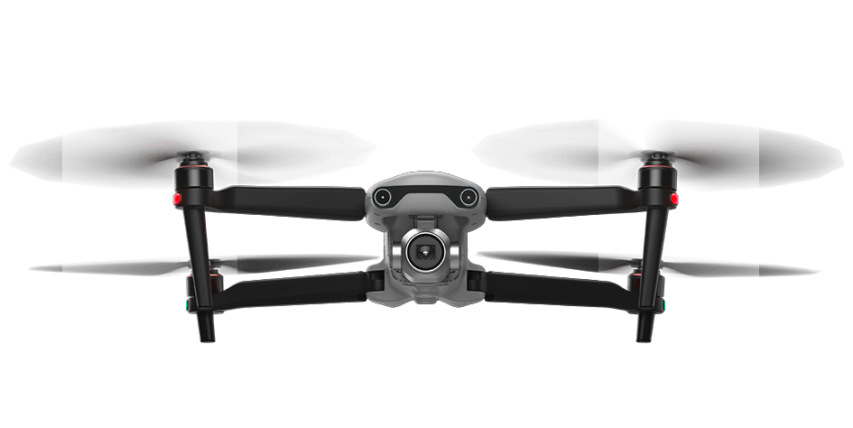
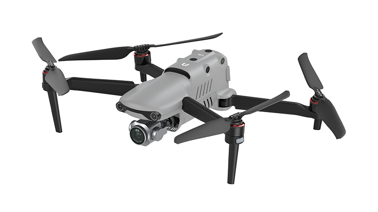
Autel Robotics EVO II Pro V3 is a folding aerial imaging platform intended for tasks including accident-scene reconstruction. Its imaging architecture combines a 20-megapixel, 1-inch CMOS camera with a three-axis stabilized gimbal. The aircraft specification includes propellers and battery in its stated weight, identifying an equipped flight platform rather than an airframe-only kit. Folded and unfolded dimensions support transport and deployment planning. The Autel Smart Controller SE, although it does not itemize purchase-package contents or specify space for additional payload hardware.
Integration centers on image capture, storage and software workflows. The manufacturer lists Pix4D, Drone Deploy and Skyebrowse for scene reconstruction. The described controller combines a 6.4-inch OLED touchscreen, removable battery and customized Android system that permits third-party app installation. Aircraft storage provides 8 GB onboard capacity and supports microSD cards up to 256 GB. These details help define the capture and control configuration for procurement. App and firmware updates are optional, but flight accidents caused by not updating fall outside warranty coverage.
The endurance footnote specifies no wind or other flight interference, obstacle avoidance set to brake, photography only, and continuous forward flight at sea level at 23 m/s until 15% battery remained. This reference test differs from the table's 20 m/s horizontal maximum in Ludicrous mode near sea level without wind. Visual sensing requires suitable texture, illumination and reflectivity; transmission distance assumes no interference or obstruction. Regional radio restrictions also apply, and published parameters may vary with environment, operating method and firmware.
Specifications
| Specification | Value & conditions |
|---|---|
| Product identity, folding architecture and deployment | Autel Robotics EVO II Pro V3; folding flight platform; published power-on-to-takeoff time: 45 seconds; app and firmware updates are not compulsory.An equipped flight platform but does not itemize package contents. Updates are not compulsory; flight accidents caused by not updating the app or firmware fall outside warranty coverage. |
| Aircraft weight and maximum takeoff weight | Aircraft weight: 1191 g; maximum takeoff weight: 1999 g outside the EU, 1270 g in the EU.Aircraft weight includes propellers and battery. Maximum takeoff weight depends on region. |
| Aircraft geometry and altitude limits |
|
| Maximum ascent, descent and horizontal speeds | Beginner/Standard/Ludicrous modes: ascent 3/5/8 m/s; descent 3/3/4 m/s; horizontal speed 3/10/20 m/s.Speeds depend on flight mode. Horizontal speeds apply near sea level without wind. |
| Maximum rotational angular speed and tilt | Rotational angular speed: 120°/s; maximum tilt: Beginner 15°, Standard 30°, Ludicrous 33°.Maximum tilt depends on flight mode. Rotational angular speed. |
| Maximum flight time, travel distance and hover time |
|
| Aircraft operating temperature, wind resistance and GNSS |
|
| Hover accuracy | Vertical: ±0.1 m with visual positioning, ±0.5 m with GNSS; horizontal: ±0.3 m with visual positioning, ±1.5 m with GNSS.Each accuracy value requires the corresponding visual positioning or GNSS system to function normally. |
| Aircraft storage | 8 GB onboard storage; microSD support up to 256 GB.256 GB is the maximum supported microSD capacity. |
| Aircraft transmission frequencies |
|
| Aircraft transmission distance and EIRP | Maximum effective signal distance: FCC 10 km, CE 8 km. EIRP: 900 MHz ≤30 dBm (FCC/ISED); 2.4 GHz ≤30 dBm (FCC/ISED), ≤20 dBm (CE/SRRC/UKCA); 5.2 GHz ≤30 dBm (FCC); 5.8 GHz ≤30 dBm (FCC/ISED/SRRC), ≤14 dBm (CE/UKCA).Signal distance requires no interference or obstruction. EIRP limits depend on frequency band and certification region. |
| Visual sensing field of view |
|
| Effective visual sensing environment | Front/rear/left/right: richly textured surfaces and illumination greater than 15 lux, described as normal indoor fluorescent lighting. Upward: diffusely reflecting surfaces with reflectivity greater than 20%, such as walls, trees or people. Downward: richly textured ground, illumination greater than 15 lux under normal indoor fluorescent lighting, and diffusely reflecting surfaces with reflectivity greater than 20%, such as walls, trees or people.Visual sensing requires the stated surface texture, illumination and reflectivity. |
| Gimbal stabilization and motion | Three-axis stabilization; mechanical pitch -135° to +45°, yaw -100° to +100°; controllable pitch -90° to +30°, yaw -90° to +90°; maximum tilt control speed 300°/s; angular vibration ±0.005°.Mechanical and controllable travel are distinct ranges. Stabilization, control-speed and vibration values. |
| Camera sensor and lens | 1-inch CMOS sensor, 20 megapixels; lens FOV 82°; equivalent focal length 29 mm; aperture f/2.8–f/11; focus range 0.5 m to infinity. |
| ISO range |
|
| Shutter speed | Photography mode: 1/8000–8 s; other modes: 1/8000–1 s.Shutter speed range depends on capture mode. |
| Zoom | 1–16× zoom; maximum 3× lossless zoom.Lossless zoom is limited to a maximum of 3×. |
| Photography modes | Single shot (default), burst, automatic exposure bracketing burst, timed photography and HDR photography.Single shot is the default photography mode. |
| Image dimensions and formats | Maximum photo dimensions: 5472 × 3648 (3:2), 5472 × 3076 (16:9), 3840 × 2160 (16:9). Formats: JPG (default), 12-bit DNG, JPG + 12-bit DNG.Image dimensions depend on the selected setting; JPG is the default format. |
| Video resolution and frame rates |
|
| Video formats, maximum bitrate and file systems | MP4/MOV with MPEG-4 AVC/H.264 or HEVC/H.265; maximum video bitrate 120 Mbps; supported file systems: FAT32/exFAT. |
| Autel Smart Controller SE dimensions and weight |
|
| Controller protection and storage | Autel Smart Controller SE: IP43 protection rating; 128 GB internal storage. |
| Controller GNSS and Wi-Fi standard | Autel Smart Controller SE: GPS + Galileo + BeiDou + GLONASS; Wi-Fi 802.11a/b/g/n/ac with 2 × 2 MIMO. |
| Controller Wi-Fi frequencies | 2.4 GHz band: 2.400–2.476 GHz or 2.400–2.4835 GHz; 5.8 GHz band: 5.725–5.829 GHz or 5.725–5.850 GHz.2.400–2.476 GHz and 5.725–5.829 GHz apply only in SRRC regions. Some frequencies are region-restricted or indoor-only; local regulations apply. |
| Purpose and software integration | Aerial imaging for accident-scene reconstruction; manufacturer-listed compatibility with Pix4D, Drone Deploy and Skyebrowse for 3D scene modeling.The manufacturer names specific software platforms. |
| Controller interface and app integration | Autel Smart Controller SE: 6.4-inch OLED touchscreen, 2340 × 1080 resolution, eight-core processor, Autel SkyLink 2.0, customized Android system permitting third-party app installation, removable battery.This controller alongside the aircraft. |
| Published-value and endurance test qualifications | Endurance test: no wind or other flight interference; obstacle avoidance set to brake; camera taking photos only; continuous forward flight at sea level at 23 m/s until 15% battery remained.Published parameters come from controlled testing and may vary with environment, operating method and firmware. The endurance test is reference-only; its stated 23 m/s differs from the table's 20 m/s Ludicrous-mode horizontal maximum near sea level without wind. |
Request a quote for Autel Robotics EVO II Pro V3
Send your application, destination country and expected quantity to the ChinaDrone team. We can discuss product selection, configuration and sourcing from China.
Submit your procurement requirements ↗No account needed. A model number is optional. Your enquiry is handled by ChinaDrone.